Cities are complex urban environments. Detailed fine grain data is increasingly needed to provide the evidence base for integrated and locally focused planning and investment decisions across the public and private sectors.
The SGS Economics and Planning Small Area Model (SAM) creates a suite of forecast variables which are:
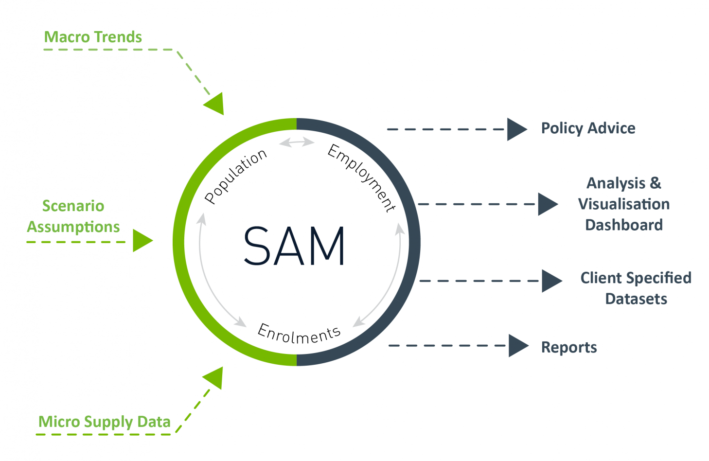
- Estimated using a combination of ‘top-down’ and ‘bottom-up’ methodologies, ensuring that macroeconomic drivers are integrated with micro spatial data and trends to provide a projection set that is robust, data driven and recognises changes in policy, demographic and economic trends at various spatial scales
- Disaggregated to a fine-grain spatial scale, allowing for custom geographies to be defined based on the scope of analysis, such as an activity centre or renewal precinct
- Developed using a dynamic and systematic algorithm that enables robust scenario testing and impact analysis using a modular framework to facilitate continuous development over time to understand how places are growing, changing, their strengths and the challenges they face
- Presented via a web-accessible and interactive platform which allows for analysis and visualisation.
Importantly, SAM can produce these forecasts using a transparent set of inputs, assumptions, and techniques. These parameters can, therefore, be altered to create sets of clearly defined scenarios, which are a key focus of policy evaluation.
SAM delivers detailed information for each scenario with over 25 million data points across three key variable types. The variable types are:
- Dwellings and population, which includes a range of household and demographic attributes
- Employment, which includes labour force status, industry and occupation attributes by place of usual residence and place of work
- Students, which includes primary/secondary/tertiary student attributes by education provider type, place of usual residence and place of institution.