Insights
Planning for natural hazards in a changing climate: best-practice principles
Posted January 16, 2020
- Local government
- State government
- Federal Government
- Business


The planning system has an important role to play in adapting to the expected impacts of climate change. Land use planning and building systems are inherently static and now need to deal with dynamic natural hazards in terms of severity and location.
While some progress has been made incorporating climate change factors into the planning and building systems, the lack of spatial understanding of the vulnerability of communities and infrastructure to climate impacts is a fundamental issue. To effectively plan for natural hazards in a changing climate, the land use planning system needs to meet the four best-practice principles outlined in this article.
The changing face of natural hazards
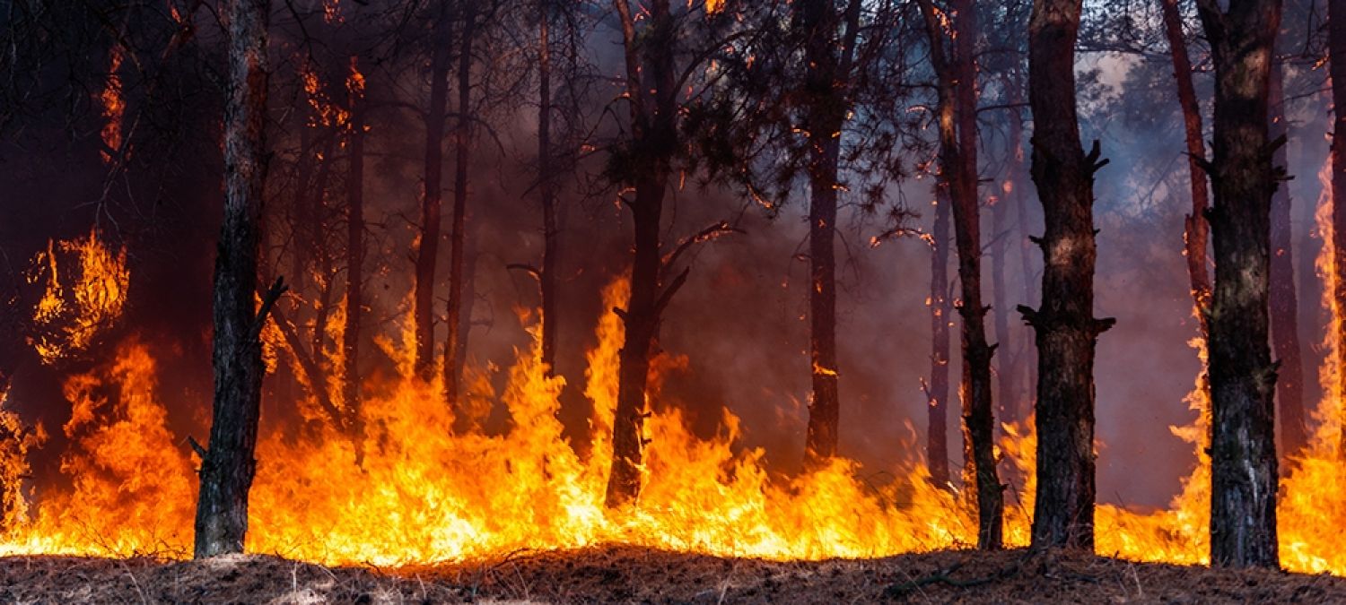
Climate change affects the frequency and severity of natural hazards, in particular heatwaves, flooding, severe storms, sea-level rise, storm surges and importantly, bushfires (IPCC, 2018). With a changing climate, fire seasons start earlier and end later, and days with dangerous fire weather increase each season. There is also less time and opportunity for bushfire fuel reduction. Some regions across Australia may be experiencing up to 45 per cent increase of extreme fire days [1] or more compared to 1990-2009 estimates the NSW Department of Planning, Infrastructure and Environment.
The social, economic and environmental impacts of bushfires are immense – which is becoming clear now some of the early effects of the 2019-20 bushfires in Victoria, New South Wales, and South Australia are being assessed.
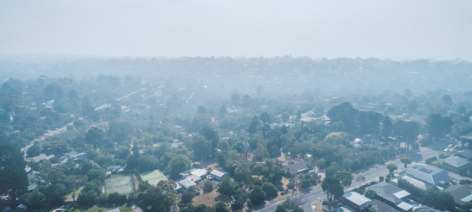
Early estimates by the SGS team indicate the cost to the Australian economy may be as high as $3.5 billion. Smoke haze in cities could cost an additional $500 million as people stay indoors, postpone spending, and call in sick with respiratory and asthma-related illnesses.
The cost to the natural world in terms of flora and fauna - and lives lost - is immeasurable. Westpac Bank estimates the bushfire crisis may cost Australia $5 billion in direct losses and reduce economic growth by 0.2 to 0.5 per cent. Some suburbs will become ‘uninsurable’ according to Climate Risk, with the number of uninsurable addresses likely to double to 720,000 if nothing is done to address escalating risk from extreme weather and climate change.
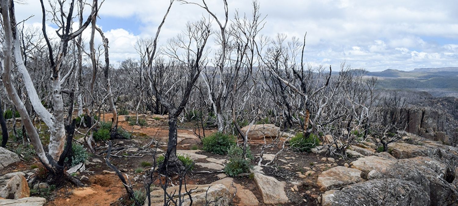
The geography of natural hazards is also changing. Places that may not be at risk today could be at risk by 2050. Some areas historically not known for bushfires, are now experiencing them. In February 2019, bushfires in Tasmania affected iconic alpine species such as the Pencil Pine, cushion plants and temperate rainforests - areas that are not supposed to burn.
It’s important that all communities understand the potential impacts of a changing climate, even if natural hazards are not part of their current experience.

The challenge of land use planning in a changing climate
Planning for natural hazards in a changing climate requires the land use planning and building systems to deal with new challenges, such as:
- How do we ensure that dwellings and neighbourhoods developed today are within acceptable levels of risk in say 30 or 50 years? For example, for flooding hazards:
- A one in 100-year average recurrence interval flood event today may occur at a much lower interval in 2040.
- Areas that are not at risk of tidal inundation today may be at risk 50 years from now as a result of sea-level rise.
- What planning horizons for the built environment do we need to take into account in decision making?
- What is the economic life of a house, and what is the economic life of a neighbourhood?
- Is the only response in land use planning to develop an area or quarantine it? Or is there a more extensive range of possible adaptation responses? Adaptation responses for communities at risk can involve a range of location-specific options: planned retreat, accommodate, and protect. How do we manage this, and what additional governance arrangements (including establishing who benefits and who pays for protection measures) and policy areas need to be involved?
- Instead of statutory responses alone, what information and policy are needed to support a more strategic response via the land use planning system?
- Is there a need to revise building standards to ensure the built environment is more resilient to projected change?
A dynamic process
The land use planning (and building) system is inherently static and does not cope well with dynamic natural hazards. Traditionally, the land use planning and building systems have relied on the assessment of risks (their geographical coverage and return intervals) by relevant natural resource management agencies when determining acceptable locations, patterns and forms of development.
These agencies assess hazards using statistically derived event return levels based on historical data. With climate change impacting on natural hazards, statistical patterns of event recurrence and intensity are becoming more dynamic. As a result, historical data is a less reliable basis for predicting future risk patterns.
To better respond to these challenges, the land use planning and building systems (including inputs and tools) need to consider natural hazards as dynamic processes.
Planning for climate-related risk
The need for companies to manage their climate-related risk is now well established. The Taskforce on Climate-related Financial Disclosures has identified that companies are responsible for identifying and managing their climate-related financial risks. Former President of the Australian Bar Association Noel Hutley SC states that directors are liable for climate-change risk as part of their duty of care and diligence (ASIC, 2018). The Australian Prudential Regulation Authority, Australian Insitute of Company Directors, and Reserve Bank of Australia support this view.
In March 2019, Guy Debelle, Reserve Bank of Australia Deputy Governor, stressed the need for financial institutions to address climate change to manage their financial risks: "The impact of climate change will prompt substantial structural adjustments to the global economy.”
“While mortgage portfolios in coastal areas may be exposed to the physical impact of climate change through rising sea levels and flooding, massive amounts of capital and new financial products will be required to fund the transition and finance climate resilience, creating demand for bank services. Meanwhile, regulators are beginning to act, and investors, clients, and civil society are looking for actions, mitigation, adaptation, and transparency on the issue," he said.
Governments should also take responsibility and reduce and manage risks to the community. However, one of the current issues in the planning system is that local planning authorities are often not required to consider climate change.
Issues when planning for changing natural hazards
In New South Wales, among other states, it is left to the discretion of local government authorities to consider climate change in their planning system. There are no state-authorised scenarios for climate change. There are councils with significant riverine flood risks that have chosen not to consider climate change in their planning system and are allowing subdivisions in floodplains. These areas may be at risk from more frequent and severe flood events in the future due to climate change.
In bushfire prone areas, planning overlays are based on historical events, not projections. For example, in Victoria, the updated Victorian Bushfire Management Overlay (BMO) and the Murrindindi Shire’s Hume Region Regional Bushfire Planning Assessment (RBPA) are both based on present-day risks. Building system requirements are also based on historical events without considering climate change. The Victorian Building Amendment (Specific Use Bushfire Protected Buildings and Other Matters) Regulations 2016 refer to present-day hazards in present-day hazards areas.
Often, there are no state standards on what consists of an acceptable level of risk over the lifetime of an asset. As a general rule, dwellings need to withstand a flood that occurs on average once every 100 years. What is then the acceptable level of risk for a retirement village, a commercial shopping area or a hospital? What is the accepted functional lifetime of individual assets, and what of integrated communities?
Progress made in recent years
Climate change adaptation methods are starting to make their way into the Australian building and planning systems. In 2016, the Victorian State Planning Policy Framework (Clause 13.01-1 (Coastal Inundation)) added a requirement to plan for possible sea-level rise of 0.2m over current one in 100-year levels by 2040 (new urban infill development), and 0.8m by 2100 for all other areas.
In Tasmania, planning schemes need to incorporate coastal erosion and storm-hazard bands. These bands identify which areas are at present-day risk of coastal hazards, by 2050 and by 2100. In 2018, the ACT Emergency Services Agency developed a tool that provides property level assessments of bushfire risk to help households and planning agencies make informed decisions.
A fundamental limitation is the lack of spatial understanding
A fundamental limitation of adaptation planning is the lack of spatial understanding of the vulnerability of communities and infrastructure to climate impacts (Measham, 2011). The cost for climate hazard mapping can be prohibitive for smaller councils and can be disputed when there is a lack of wider regional, state or even national consistency concerning climate change scenarios, acceptable levels of risk and agreed data sources.
The land use planning system provides arguably the “most crucial tools available to local government in driving adaptation to climate change” (Measham, 2011). Land use planning can be used to ensure hazard-free land is available for development, and to use the post-disaster window of opportunity to encourage individual developments to retrofit or relocate (Burby, et al., 2000). Failing to use the land use system effectively can result in perverse outcomes.
As an example, despite the royal commission into the 2009 Black Saturday bushfires recommending against rebuilding in some of the most fire-prone areas, more residents now live there according to The Sydney Morning Herald: “Kinglake's population fell after the fires, as people left. But new housing estates in the tree-covered mountains are drawing newcomers. Half the town's population are newcomers, real estate agents estimate. There are now almost as many people as the town's 2008 peak - and about 20 per cent more houses."
Adaptation includes managed retreat (or avoidance [2]) and protection (or accommodation [3]). Zones and overlays are generally not configured to managing land use and development on a temporal basis. With dynamic natural hazards, the planning system needs tools to enable the roll-out of spatial adaptation strategies, including a managed retreat.
Managing exposure to climate change hazards through land use planning
Best practice principles
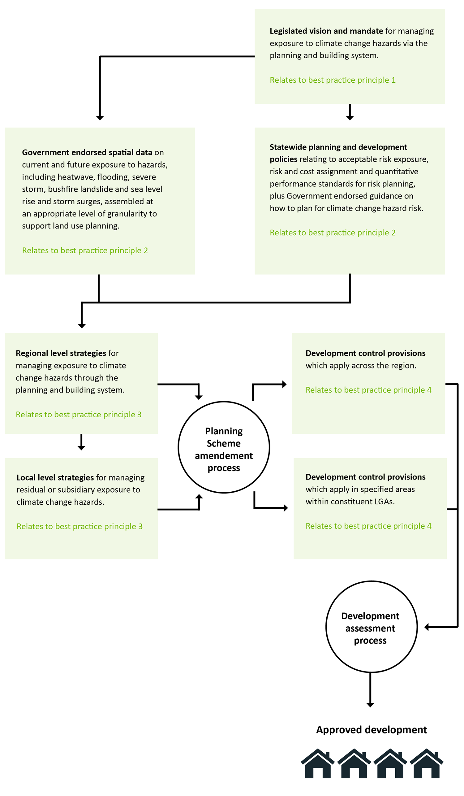
To effectively plan for natural hazards in a changing climate, the land use planning system needs to meet four best practice principles:
- A clear mandate in legislation for the land use planning and building system to tackle dynamic climate change hazards. This mandate may require state planning acts and state LGA acts to be amended to manage the impacts of climate change and changing natural hazards as a function of the planning system and a function of local government.
- State-wide policies agreed data and guidance drive the formulation of settlement and development strategies and regulations. This includes hazard mapping: comprehensive, Government-authorised and freely available spatial data and projections on climate change hazards, prepared at a sufficient level of granularity to support local area land use planning and development control. While increasingly more small area projections of climate change impacts are being made available [4], they may not always be of sufficient granularity or up-to-date. It also includes policies and standards on acceptable levels of risk over the (functional or economic) lifetime of the built environment, individual assets and communities.
- Nested, statutorily binding, plans and regulations which translate state-wide policy statements down to the regional and local level A subsidiarity-based approach to strategic land use planning which allows regional level issues to be dealt with in a binding way in planning schemes while allowing local communities – through their local Councils – to devise preferred customised responses to managing risk exposure, where local discretion is possible and desirable. While this exists for land use planning overall, climate change adaptation has not systematically been integrated into this.
- Appropriate statutory mechanisms. Effective development control provisions that enable regions and local councils to manage natural hazard management and climate change adaptation strategies. This could include introducing a climate change adaptation management overlay to replace or add to existing hazard overlays. Or introducing zonings which reflect the strategic adaptation response, including retreat or protection zones.
The planning profession should support and inform state and territory government on the specific gaps and opportunities for improvement in each jurisdiction. It is an acute call for action as it becomes increasingly evident that the pace of climate change is faster than previously expected.
FIGURE 1: BEST PRACTICE IN MANAGING EXPOSURE TO CLIMATE CHANGE HAZARDS THROUGH THE LAND USE PLANNING AND BUILDING SYSTEM

Renowned climate scientist Dr Joelle Gergis is a key contributor to the United Nations Intergovernmental Panel on Climate Change’s (IPCC) sixth assessment report, currently underway and expected by 2022 (Gergis, 2019). She explains the current modelling paints a grim picture with global temperature changes of around 5°C by 2060 if we do not drastically reduce emissions. The global temperature has risen 0.8°C since pre-industrial times. This means that the pace of change will accelerate from about 0.8°C in 140 years to 1°C each decade on average from now (an acceleration of 17 times) [5].
Now is the time for the planning profession to help governments proactively adapt to natural hazards in a changing climate, without exacerbating climate change by increasing greenhouse gas emissions (maladaptation).
References
Footnotes
1. Macarthur Forest Fire Danger Index with scores over 50 2. Ensure that new developments of private and public infrastructure and assets are not permitted in areas likely to be affected by climate change, without substantial planning controls being implemented (NCCARF, 2017) 3. Consolidate urban development by favouring infill and redevelopment of existing urban areas to minimise urban sprawl into highly vulnerable coastal areas (NCCARF, 2017) 4. Such as the NARCliM data available via Adapt NSW, providing small area projections for NSW and ACT for a number of climate variables and climate impacts including bushfires 5. The use of averages distorts the fact that the acceleration is not even over the coming decades.
Sources
9News, 2020. Fires Australia: Bushfire crisis could cost country $5b, harm economic growth. 9News, 13 January.
ABC, 2019. The rise of red zones of risk. ABC, 23 October.
ASIC, 2018. Financing a Sustainable Economy, Sydney: ASIC.
Burby, R., Doyle, R., Godschalk, D. & Olshansky, R., 2000. Creating Hazard Resilient Communities through Land-Use Planning. Natural Hazards Review, Volume 1.
Bureau of Meteorology, 2018. State of the Climate 2018. [Online] Available at: http://www.bom.gov.au/state-of... [Accessed 9 January 2020].
Debelle, G., 2019. Climate Change and the Economy. Sydney, Reserve Bank of Australia.
Gergis, N., 2019. The terrible truth of climate change. The latest science is alarming, even for scientists. The Monthly, August.
Government News, 2018. ACT emergency services create world-first bushfire map. Government News, 10 September.
IPCC, 2018. A Special Report of Working Groups I and II of the Intergovernmental Panel on Climate. 3 Changes in Climate Extremes and their Impacts on the Natural Physical Environment, Cambridge, UK: IPCC.
Measham, T. P. B. S. T. e. a., 2011. Adapting to climate change through local municipal planning: barriers and challenges. Mitig Adapt Strateg Glob Change, Volume 16, p. 889–909.
NSW Department of Environment and Heritage, 2014. Australian Capital Territory Climate Change snapshot, Sydney: OEH.
NSW Department of Planning, Infrastructure and Environment, 2020. NSW Adapt. [Online] Available at: https://climatechange.environm... [Accessed 9 January 2020].
State of NSW and Office of Environment and Heritage, 2015. Climate Change Impacts on Bushfire Risk in NSW, Sydney: State of NSW and Office of Environment and Heritage.
Sydney Morning Herald, 2019. In the path of disaster: The big causes of bushfires that most of us are missing, Sydney: SMH.
Sydney Morning Herald, 2020. Ross Garnaut's climate change prediction is coming true and it's going to cost Australia billions, experts warn. Sydney Morning Herald, 8 January.
Connect with us on LinkedIn
- Local government
- State government
- Federal Government
- Business